Subject as Japan is to disasters, firms in the country have been actively developing technology to prevent and mitigate the resulting damage. The Institute for Q-shu Pioneers of Space, Inc. (iQPS), a Japanese startup company, aims to acquire near-real-time observation data by launching numerous small synthetic aperture radar (SAR) satellites into orbit and operating them integrally, and also aims to provide the collected data to help mitigate the impact of disasters worldwide.

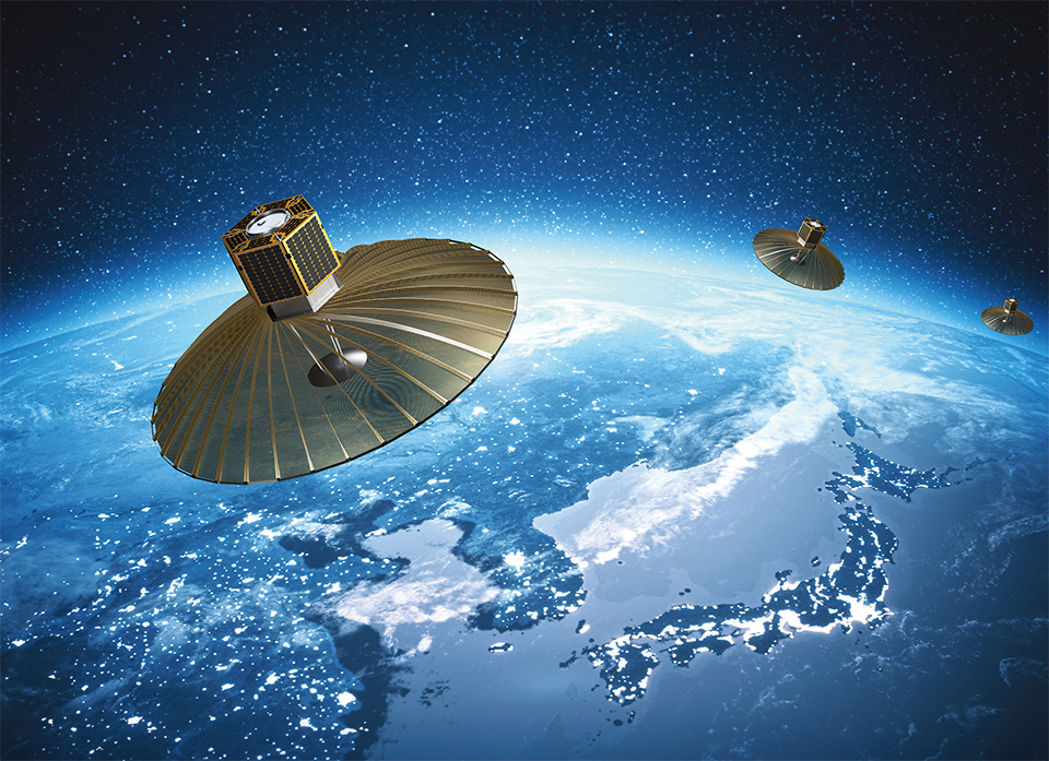
An illustrative image of the compact, high-resolution QPS-SAR orbiting the Earth. The satellite was developed by a Japanese startup, the Institute for Q-shu Pioneers of Space, Inc. (iQPS).
The Noto Peninsula was rocked by a giant earthquake on New Year’s Day of 2024. Although access to the peninsula had always been problematic due to its mountainous terrain, much of the area became a virtual “landlocked island” after a good part of its road network was disrupted by the earthquake. Consequently, it was extremely difficult to assess the extent of damage, a necessary step before any aid could reach the area and rebuilding efforts get started.
One company stepped in quickly to provide high-resolution satellite images of the affected area to governments and media agencies. That company was the Institute for Q-shu Pioneers of Space, Inc. (iQPS). Founded in the Japan’s southwest Kyushu Region (stylized as “Q-Shu” in the company’s name) in 2005, iQPS builds satellites based on small-satellite development technology from Kyushu University.
The satellite used by iQPS to observe the earthquake-hit areas on the Noto Peninsula was its own, uniquely developed small synthetic aperture radar (SAR) satellite, “QPS-SAR.” Unlike many traditional Earth observation satellites, which take images of terrain through optical sensor-based cameras and are thus unable to capture data at night or in poor weather, SAR satellites emit microwaves that penetrate clouds and ash, gathering distance information from the reflected microwaves to create images. Although the resulting images are black and white, they can be obtained even at night or in bad weather. Considering that 50% of the Earth is always night and that 50% is covered with cloud, according to the Japan Meteorological Agency, SAR has clear advantages.
According to HIRATA Daisuke, General Manager of the company’s Solution Business Department, “Since 2022, as a selected operator for the Cabinet Office’s ‘demonstration project for expanding the use of small SAR satellite constellations,’ our company has boosted its cooperation with government ministries and agencies, facilitating emergency observation and rapid data provision after the 2024 Noto Peninsula Earthquake. We have made continuous observations of the affected area ever since the disaster struck. Therefore, even when heavy rains inundated the region in September of the same year, we could promptly assess the extent of landslide damage by comparing observation data from before and after.”


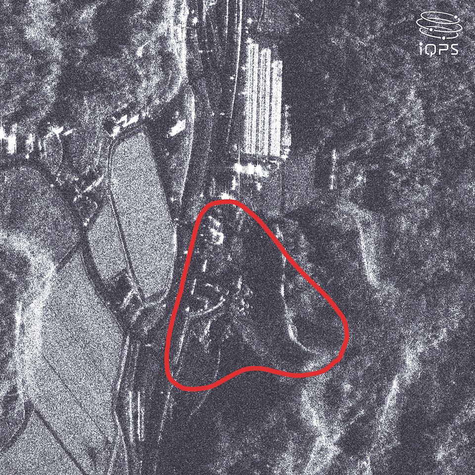
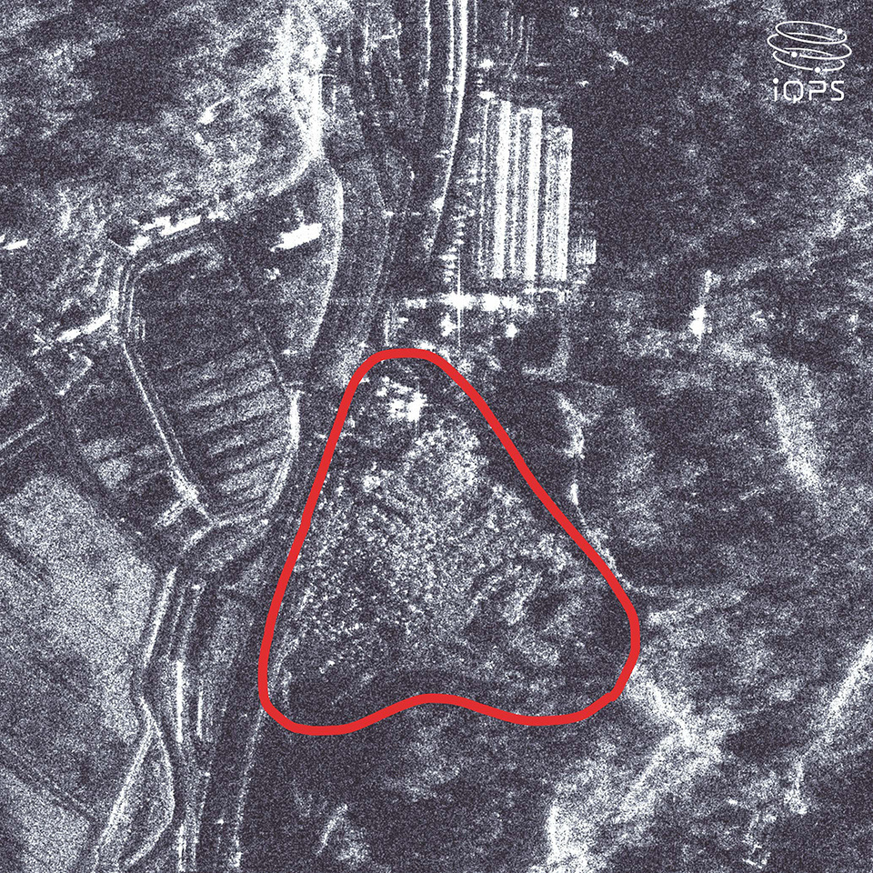
Two high-resolution images of Suzu City taken by QPS-SAR. Comparing the two images reveals landslides triggered by the 2024 Noto Peninsula Earthquake.
Left: Before the quake, on December 14, 2023.
Right: After the quake, on January 3, 2024.
Globally, only five private companies have successfully developed, operated, and captured images with small SAR satellites. iQPS’s proven strength lies in drastically reducing the weight and cost of its products, as well as in improving image quality and resolution. While conventional large SAR satellites generally weigh several tons and cost tens of billions of yen, QPS-SAR satellites can achieve a high resolution of 46 cm, weigh just at the 100-kg level, and cost a few hundred million yen (as of October 2024).
Achieving higher resolution requires larger antennas to transmit and receive microwaves, such that tradeoffs are generally involved when trying to balance compactness, lighter weight, and high resolution. To address this, iQPS has successfully developed a large, deployable antenna using lightweight metallic mesh. The antenna is compactly folded at launch and then deployed in space using spring mechanisms, enabling satellite size and weight to be reduced while increasing image resolution.
“Our firm is in the northern Kyushu region, known for its high concentration of automotive and other manufacturing companies, and QPS-SAR is a crystallization of that accumulated know-how,” explains Hirata.
Weight reduction and miniaturization offer the benefit of lowering launch costs, making it practical to send numerous satellites into orbit simultaneously, making up a satellite constellation that can be operated in concert for high-frequency observations. The firm has already launched up to its eighth QPS-SAR satellite and now operates three of them commercially, allowing it to provide data to clients within about 24 hours of receiving a request. Its immediate goal is to have 24 satellites in orbit by mid-2028, and ultimately create a constellation of 36 satellites, providing a “near-real-time” data service that permits observations of almost anywhere in the world at average ten-minute intervals.

The April 2024 launch of QPS-SAR-7 “TSUKUYOMI-II.” SPACE X
“We believe that SAR satellites, which can acquire wide-area data rapidly, will significantly contribute to better evacuation and disaster relief efforts, making them prompter and more efficient,” said Hirata. “We are also conducting demonstrations of our technology overseas, aiming to provide our services globally in the event of future disasters.”
In a world increasingly subject to extreme weather events due to the advancement of climate change, data from a constellation of small SAR satellites could allow rapid identification of disaster damage and potentially minimize secondary disaster impacts.


